Vietnam Topography
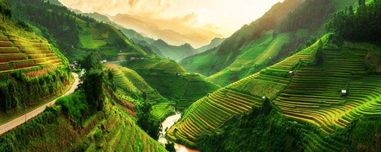
Three quarters of Viet Nam's territory consists of mountains and hills. Viet Nam is divided into four distinct mountainous zones.
The Northeastern Zone (Viet Bac)
This zone stretches from the Red River Valley to the Gulf of Tonkin. The mountainous area of Viet Bac is scattered with famous sights: Dong Nhat Grotto, Dong Nhi Grotto, and Tam Thanh Grotto in Lang Son Province; Pac Bo Grotto and Ban Gioc Waterfall in Cao Bang; Ba Be Lake in Bac Kan; Yen Tu Mountain and Ha Long Bay in Quang Ninh; and Tay Con Linh, the highest mountain peak in the region reaching 2,341 meters above sea level.

The Northwestern Zone
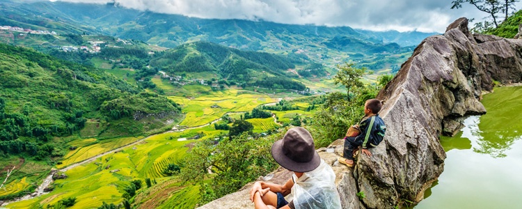
This zone is comprised of mountains that run from the north of the Sino-Vietnamese border to the west of Thanh Hoa Province. This magnificent mountain range is nationally known for its resort town of Sapa in Lao Cai Province, which is perched 1500 meters above sea level. Several ethnic groups, such as the H'mong, Dao, Kinh, Tay, Giay, Hoa, and Xa Pho, still reside in this region.

The northwestern zone is also famous for the historical site of Dien Bien Phu and Fansipan Mountain, which measures 3,143 meters above sea level at the peak.
The North Truong Son Zone
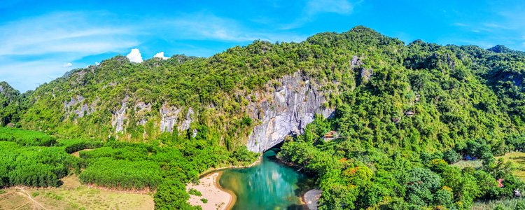
This zone runs from the western part of Thanh Hoa Province to the Quang Nam-Da Nang Mountains. This region is known locally for its picturesque Phong Nha Grotto and its two breathtaking passes, the Ngang Pass and the Hai Van Pass. It is also known worldwide for being the location of the legendary Ho Chi Minh Trail constructed during the second great resistance war.

The South Truong Son Zone
This zone is located to the west of the south central coast provinces. Behind these huge mountains is a vast area of red soil known locally as "Tay Nguyen" (the Central Highlands). There are numerous legendary accounts of the flora and fauna and of the lives of several different ethnic minorities living in the Central Highlands. Dalat, established during the 19th century, is a popular resort town in this part of Viet Nam.
Viet Nam has two major deltas, including the Red River Delta in the north and the Mekong River Delta in the south.
The Red River Delta, or Northern Delta
This region stretches for15,000 sq. km. Over time, deposits of alluvium carried from the Red River and Thai Binh River have accumulated to form the delta. The ancient Viet people settled at the junction of the two rivers . At that time, the wet rice civilization was established
The Mekong River Delta, or Southern Delta
This region is approximately 40,000 sq. km. The land is very fertile and has favorable climate conditions for agriculture. As a result, it is the largest rice growing region in Viet Nam.
Viet Nam is crisscrossed by thousands of streams and rivers. There is a river discharging every 20 kilometers along Viet Nam's coastline. The waterways are a very convenient means of transport with major rivers like the Red River in the north and the Mekong River in the south.
Related Articles
- Where Is Vietnam on the World Map? Location Explained
- Vietnamese Language: A Complete Guide for Travelers
- Official Vietnam Flag: History, Meaning, Colors, and Usage
- Phu Quoc Weather: Best Time to Visit & Seasonal Travel Guide
- Moc Chau: Highland paradise of tea hills & cultural adventures
- Team building and CSR activities in Vietnam: Visa services
- Honeymoon in Vietnam: Best romantic packages for couples
- Amanoi Resort in Vietnam: Luxury retreat in Vinh Hy Bay
- Six Senses resorts in Vietnam: Ninh Van Bay and Con Dao
- Con Dao Island: A historical and natural paradise in Vietnam
HOW CAN WE HELP?
APPLY WITH CONFIDENCE


